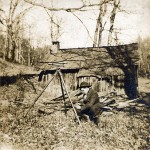
Completing a boundary survey is not as simple as it may sound. When retracing a boundary it is important to gather all the research and data to a point that confirms from all available evidence that the line marked is the correct location. This may require looking past the seemingly obvious and digging deeper to be assured of the conclusions.
It is also imperative to consider evidence that may point to unwritten titles that may have ripened into property rights and give a full report of those findings.
Measuring of America
 “God did make the world to be inhabited by mankind, and to have his name known to all nations, and from generation to generation as the people increased and dispersed themselves into such countries as they found most convenient.
And there in Florida, Virginia, New England and Canada is more land than all the people of Christendom can cultivate, and yet more to spare than all the natives of those countries can use and cultivate.
And shall we here keep such a small island, and at such great rents and rates, where there is so much of the world uninhabited, and as much more in other places, and as good or rather better than any we now posses, were it cultivated and used accordingly?”
— John Smith, Advertismentz for the Inexperienced planter of New England, Haviland, London, 1631
2009 Manual of Survey Instructions
The Manual of Surveying Instructions describes how cadastral surveys of the public lands are made in conformance to statutory law and its judicial interpretation… Previous editions of the Manual were issued in 1855 reprinted as the Manual of 1871, 1881, 1890, 1894, 1902, 1930, 1947 and 1973.
The Manual of Survey Instructions describes how cadastral surveys are made in conformance with statutory law and its judicial interpretation. The manual is not intended to limit the survey authority or practices of any Federal agency other than the BLM.
Surveying, in general, is the art of measuring and locating lines, angles, and elevations on the surface of the earth, within underground workings, and on the beds of bodies of water. A “cadastral survey” creates (or re-establishes), marks, and defines boundaries of tracts of land.
In the general plan, each cadastral/official survey includes: a request for survey; special instructions; assignment instructions; a field note record of the observations, measurements, and monuments descriptive of the work performed; and a plat representing the official survey. All subject to approval, and/or acceptance of the Director, Bureau of Land Management.
History of Boundaries
“History of the development of surveying boundaries:
The role of the survey and its function have been closely and inseparably tied in with the progress of civilization.
When man was in his first stage of development – only a hunter and a fisherman – he had no need for exact limitations of boundaries and his title to real estate was nebulous. Thus, in early American history, the territory which is now the state of Kentucky was commonly referred to as the “dark and bloody ground” because it was a hunting and fishing area used by both the Cherokee and other southern tribes and by Miami and Iroquois confederacies from the north.
When man entered his second or pastoral stage, still there was no need for exact limit of the pastoral area. Chapter 14 of the Book of Genesis makes no reference to any difficulty experienced by Abraham in defending his boundary against marauders. Instead, it is the cattle and goods which are the subject of his care.
When man began to cultivate the soil, however, it became necessary for the sake of peace and harmony that there be definite boundaries established. So we note that Jacob was required to purchase a definite heritage when he entered the land of Canaan (Genesis 33:19).
At this moment the role of the surveyor became of vital importance to the community…..”
— “Clark on Surveying and Boundaries” 4th Edition Author John S. Grimes
